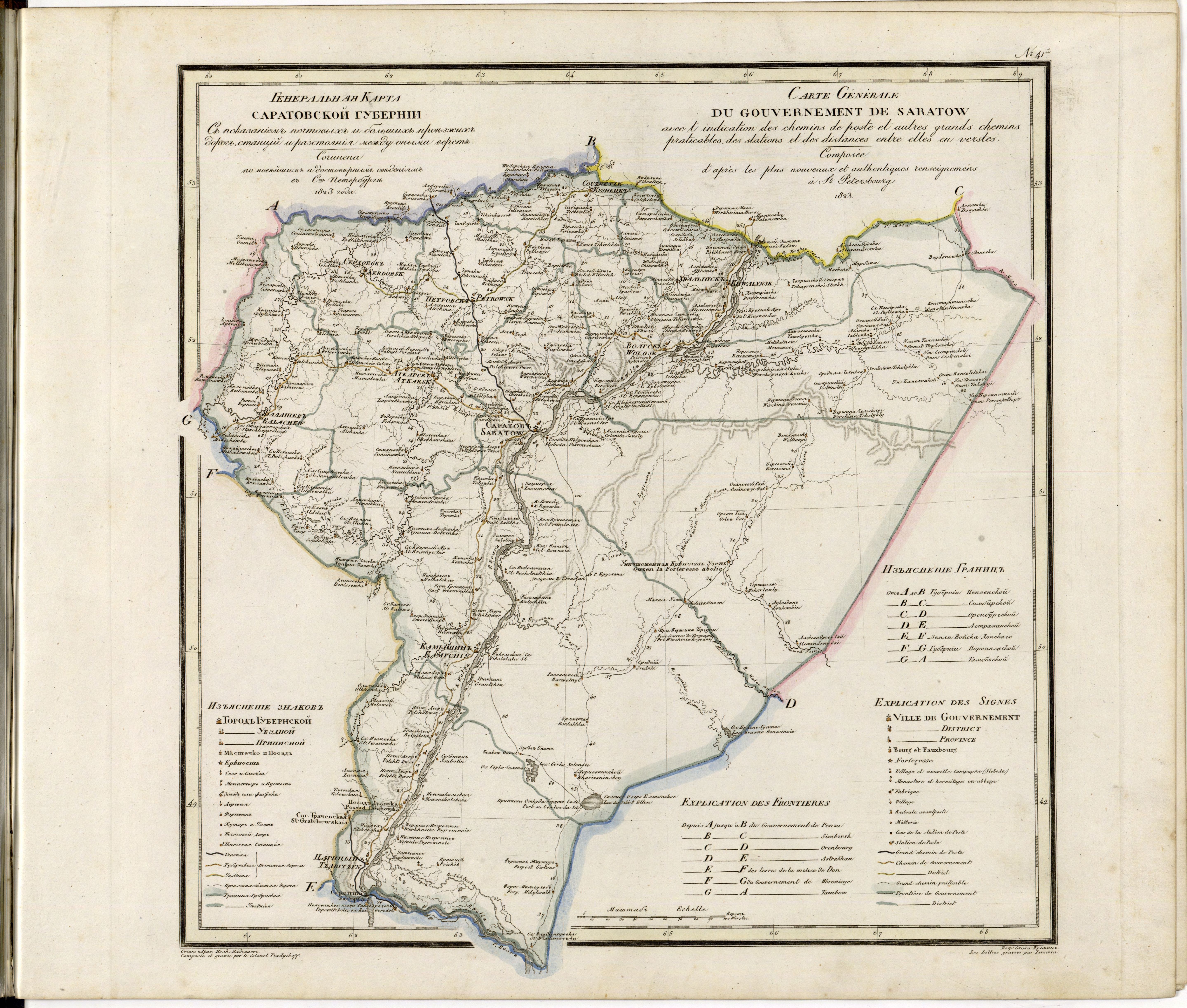
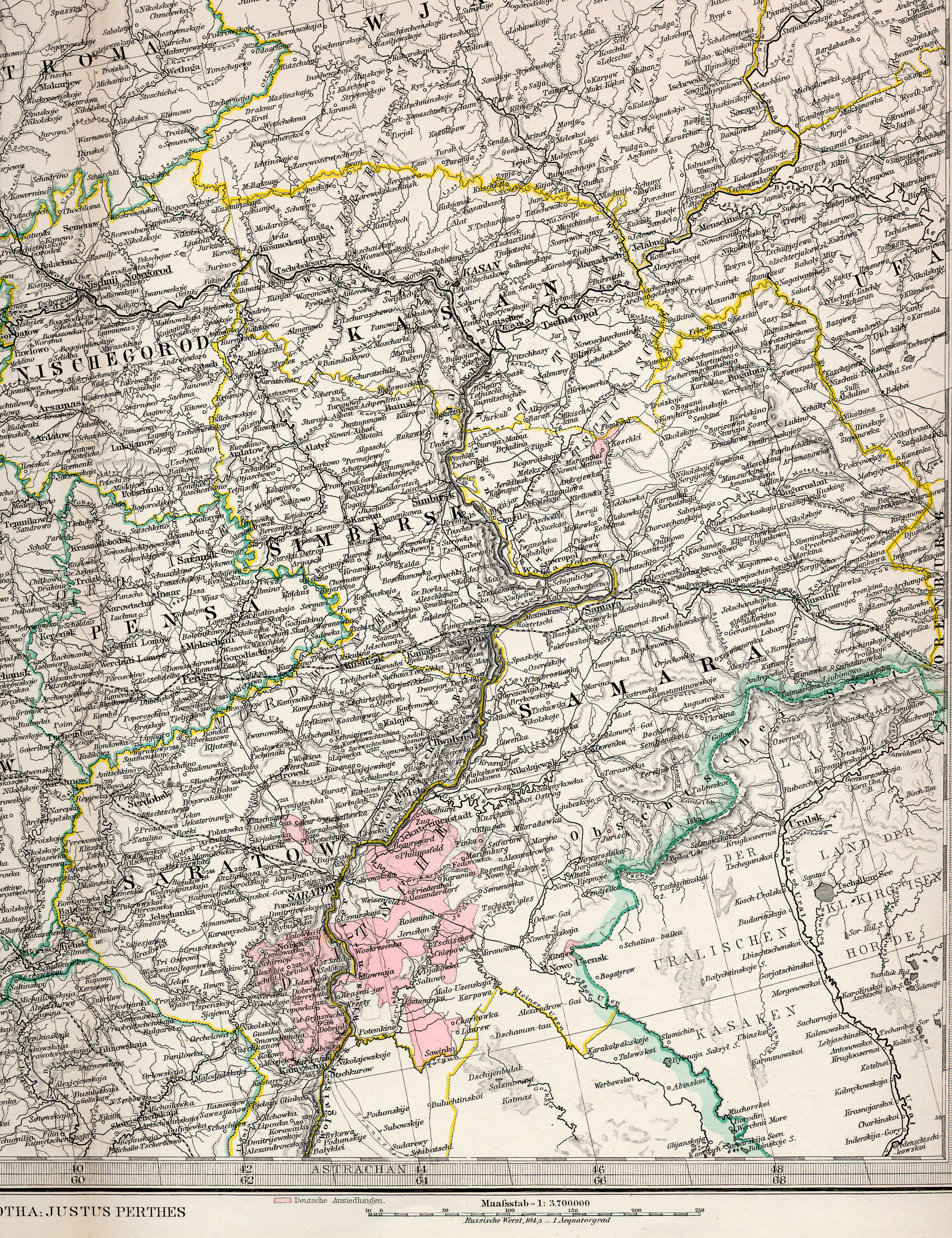
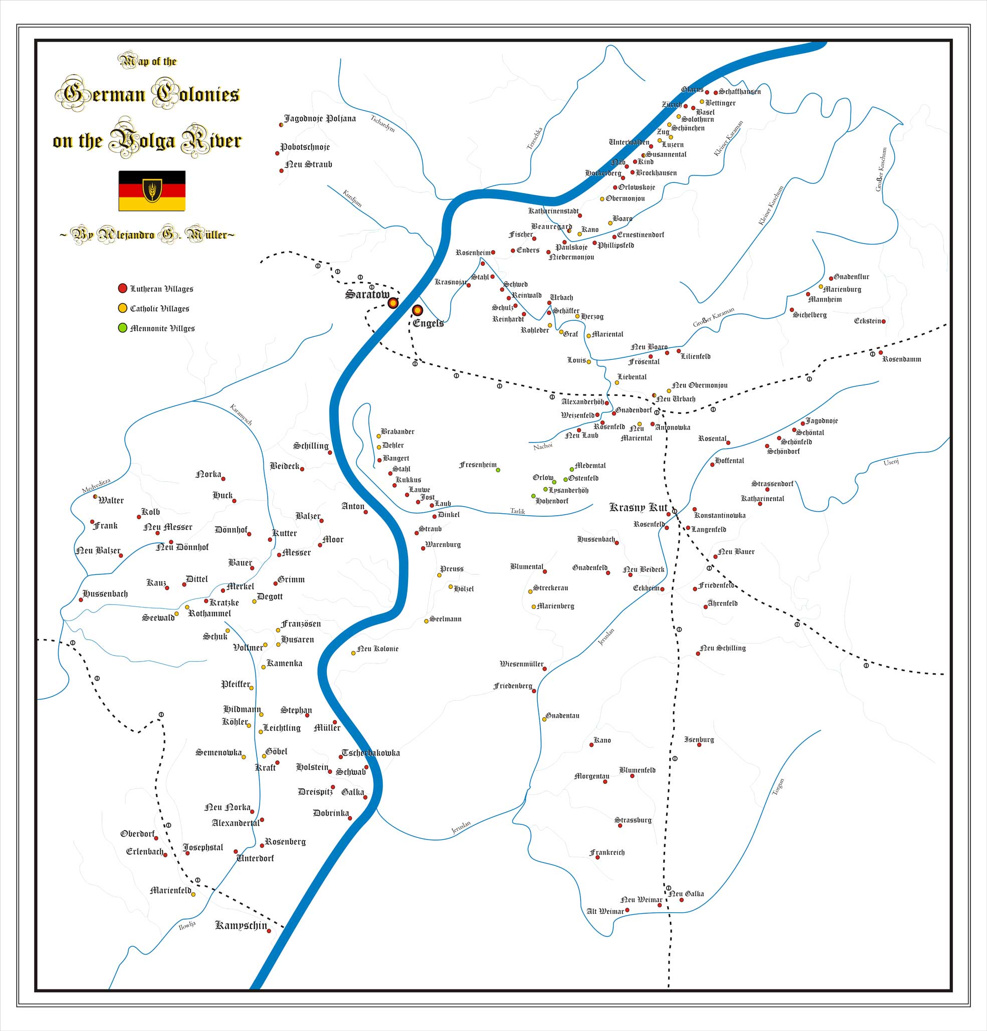
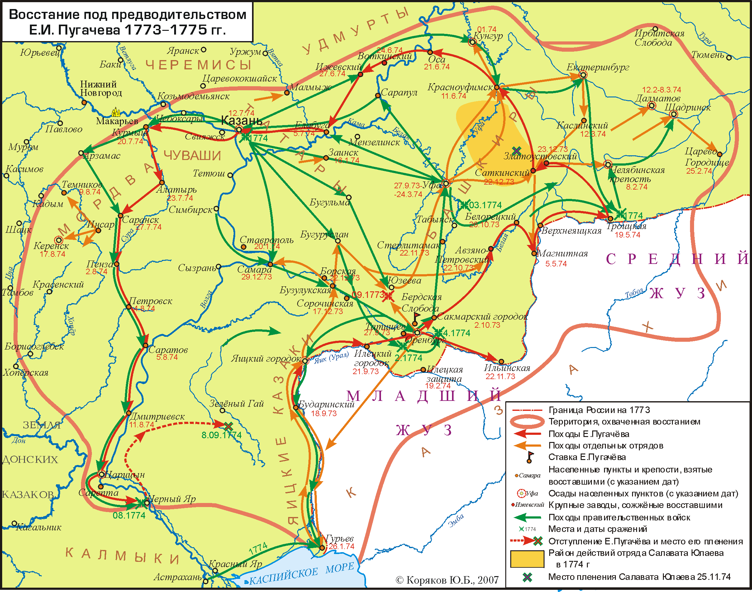
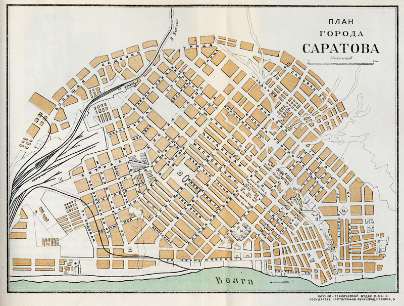
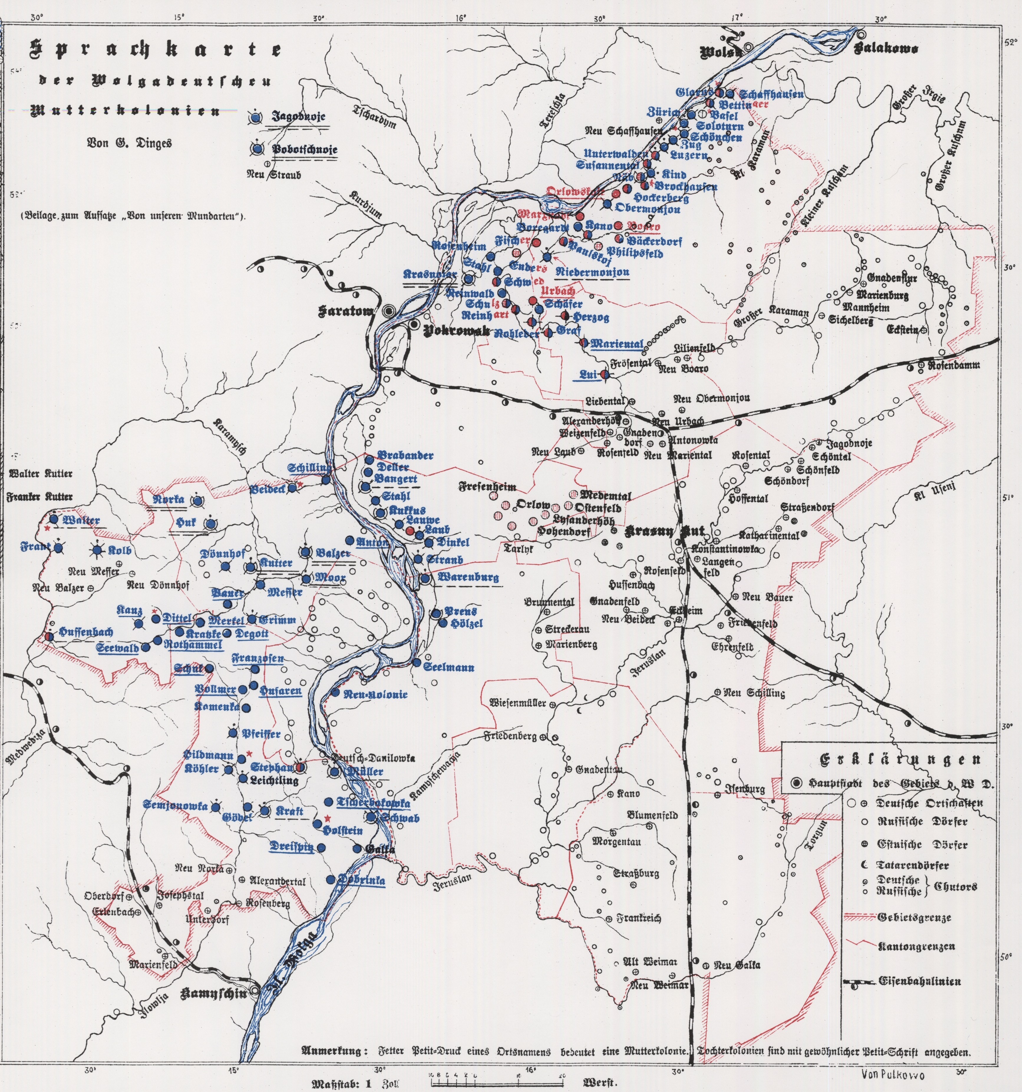
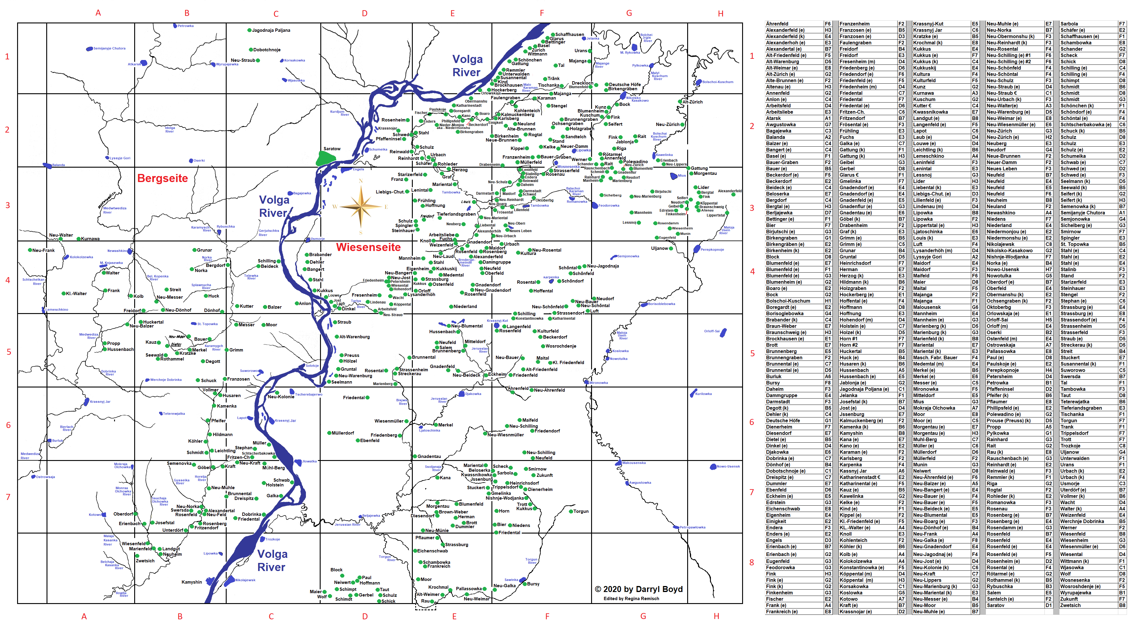
Map of the Saratov District. Geographic Atlas of the Russian Empire (1823). French/Russian by Piadycheff. Note: Not all extant Volga German colonies are shown. Courtesy of Steve Schreiber.1882 Map of the Saratov area by Stieler. Courtesy of Steve Schreiber.Map of the German Colonies on the Volga River by Alejandro G. Müller.Map showing the movements of Pugachev (1773-1775). Source: unknown.Ethnic Map of the Volga Region (1901). [Germans in Blue] Source: Russia : Full Geographical Description of Our Country (St. Petersburg: A.F. DeVries, 1901): n.6. Courtesy of Steve Schreiber.1925 Map of Saratov. Source: Vera Beljakova-Miller.1923 map of the German dialects evident among the Volga Colonies by Georg Dinges. Map available for purchase from AHSGR.
![Ethnic Map of the Volga Region (1901) [Germans in Blue] Source: Russia : Full Geographical Description of Our Country (St. Petersburg: A.F. DeVries, 1901): n.6.](/sites/default/files/inline-images/ethnic_map_1901.jpg)